Skip to content
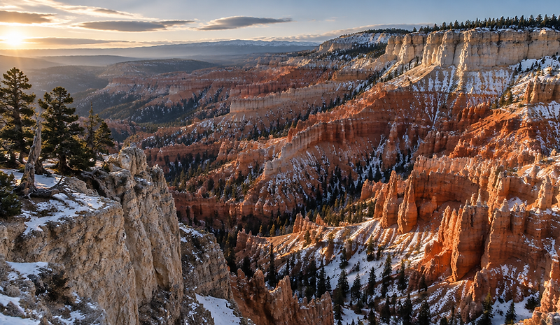
Vast eroded sandstone amphitheatre with layered red cliffs and snow on the rim

Field guide · Duck Creek Village

Explore Southern Utah

Duck Creek Village sits at roughly 8,400 feet on Cedar Mountain, surrounded by the Dixie National Forest and within reach of two national parks. This is a guide to what is actually around you — and to the things worth checking before you commit to a plan.

Distances, drive times and opening details below are approximate and change with the season. Verify current road, trail, park and fire-restriction information before you set out.

Seasons

What the mountain does through the year

At roughly 8,400 feet, the calendar up here runs later than most visitors expect. Plan around the season, not the date.

Winter

December – March
  • Snowmobiling the forest roads
  • Snowshoeing and winter walks
  • Cabin weekends in the village
  • Snow-dusted overlooks

Snow and access change weekly. Some forest roads and the Cedar Breaks road are seasonally closed — check before you drive.
Spring

April – May
  • Shoulder-season quiet
  • Wildlife watching
  • Fishing as the lakes open
  • Lower-elevation hikes

Higher trails and roads open later than you expect. Mud season can limit off-road access.

Summer

June – August
  • SxS and UTV trail riding
  • Alpine lake days at Navajo Lake
  • Hiking and overlook drives
  • Cool evenings around a fire

Peak season. Book cabins and machines early, and watch for afternoon storms and fire restrictions.

Autumn

September – November
  • Aspens turning gold
  • Photography drives
  • Riding with fewer people on the trails
  • Early snowmobile prep

The most beautiful weeks of the year, and the shortest. Early snow can close higher routes quickly.

Destinations

Where to point the machine or the car

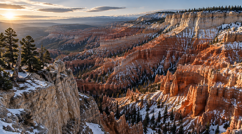
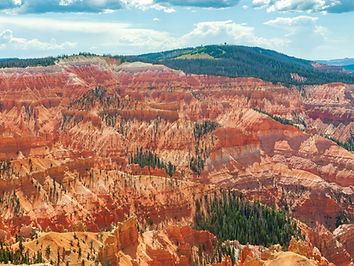
Cedar Breaks amphitheater filled with orange and red limestone hoodoos under a blue sky

Cedar Breaks National Monument

About 20 minutes north on UT-143

A natural amphitheatre over 2,000 feet deep, with the rim road running along the top. Wildflowers in midsummer, snow up high well into spring.

The UT-143 access to the rim is seasonally closed by snow — confirm before you drive.

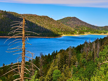
Deep blue Navajo Lake surrounded by dense conifer forest under a clear blue sky

Navajo Lake

Under 15 minutes

A high alpine lake ringed by spruce forest on the edge of the Markagunt Plateau — calm mornings, cool water and a good spot to slow down.

Fishing rules, access and boat launch conditions are seasonal.

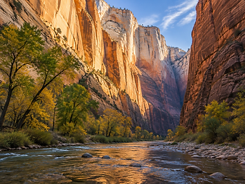
Canyon of enormous pale sandstone walls with a river running along the floor

Zion National Park

About an hour and a half via UT-9

The big one. Towering sandstone walls and the Virgin River, and a completely different landscape from the forest you wake up in.

Timed-entry, shuttle and parking rules change by season — check park information before you go.

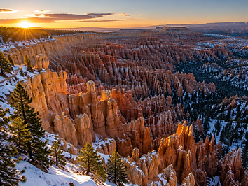
Sunrise light on thousands of orange sandstone hoodoos filling an amphitheatre

Bryce Canyon National Park

About an hour

Hoodoos at sunrise, cold air and long views. Reachable as an early day trip from a Wildpoint cabin without changing base camp.

Seasonal shuttle service, road closures and trail conditions vary — confirm on the day.

Duck Creek Trail & Mammoth Cave

Minutes from the village

A forested trail close to the village that leads past Mammoth Cave, a lava tube you can walk to and look inside. An easy half-day, right on the doorstep.

Trailhead parking and trail conditions vary with season and snowfall.

Strawberry Point

Roughly 30 minutes on graded forest roads

A dramatic overlook on the edge of the plateau with the forest falling away below. A classic SxS destination on a clear day.

Forest roads can be rough, washed out or closed — check access and use an appropriate vehicle.

Panguitch Lake

About 35 minutes

A larger reservoir known for its fishing, with quiet shores and a small settlement around it. A good change of scenery from the plateau.

Fishing regulations and marina services are seasonal.

Brian Head

About 40 minutes

Ski terrain in winter and lift-served mountain biking and hiking in summer, up above 9,000 feet. Useful when the family wants something different for a day.

Lift operating days and snow conditions change through the season.

Red Canyon & Panguitch

About 50 minutes

Red rock hoodoos right beside the highway on the way to Bryce, with a small historic town further on for fuel and food.

Highway conditions can change fast in winter — check UDOT before you travel.

Itineraries

Sample trips you can copy

Three ways guests use Wildpoint as a base. Adjust to your own pace — none of these need a tight schedule.

A summer weekend up the mountain

Friday
Arrive, settle into the cabin, walk the Duck Creek Trail before dark.
Saturday
SxS out early, ride to a plateau overlook for lunch, back before the afternoon storms.
Sunday
Slow morning by the lake, then the drive home via Cedar Breaks if the rim road is open.

A winter weekend on the snow

Friday
Drive up in daylight, check road conditions, cabin fire lit by evening.
Saturday
Snowmobile on the forest roads, back early enough to thaw out and eat well.
Sunday
A short snowshoe or a slow morning, then home before the afternoon snow.

Using Wildpoint as a national-parks base

Day 1
Bryce Canyon at sunrise — leave early, it is about an hour.
Day 2
Stay local: SxS or a lake day, no long drives, kids happy.
Day 3
Zion, if you are willing to make a long day of it and start before dawn.

Practical info

Before you arrive

Fuel and supplies
Duck Creek Village is small — a general store and limited services. Fuel up in Cedar City, Panguitch or Brian Head before heading up, especially late in the day.
Food and dining
Village restaurant and store hours vary by season and can close early. If you are arriving late, bring what you need for the first night.
Elevation and weather
You are at roughly 8,400 feet. Days feel colder and stronger than the forecast suggests, and weather can change within an hour.
Cell and internet
Coverage is patchy outside the village. Get directions and confirm plans before you lose signal.
Winter travel
UT-14 and UT-143 can require snow tyres or chains. Check UDOT road conditions before you drive up Cedar Mountain.

Safety & prep

Small habits, better days

  • Tell someone your route and your expected return time.
  • Carry more water than you think you need — the elevation dehydrates you.
  • Layers, always. A warm afternoon turns into a cold evening quickly.
  • Never rely on a single device for navigation; paper or downloaded maps still work.
  • Respect closures. Fire restrictions and road closures exist for good reasons.
  • Pack out everything you bring in, and stay on established routes.

Ride responsibly

Stay on established routes, respect closures and other visitors, and pack out everything you bring in. Access to these trails depends on everyone doing the same.

See rental requirements

Make it a trip

Stay close to everything above

A Wildpoint cabin puts the parks, the lakes and the trails within a day trip — and the machines to reach them a few minutes away.

    base44
    Edit with Base44